O Marathon II
Saturday, Dec. 12, 2009
Fair Hill NRMA, Fair Hill, MD


Results (updated 12/13/09 9:56 PM)

O Marathon II

    Long distance orienteering returns to Fair Hill in a big way on Saturday Dec. 12th with both half marathon and full marathon courses offered. Don't miss this opportunity for one last good O fix before the long cold winter sets in. Proceeds from this event will benefit the US Orienteering Team.

Revision History

    12-07-09 -- Updated number of controls on half marathon.
    12-04-09 -- Added detailed directions (inline and MS-Word format).
     
    11-13-09 -- Added a weather widget.
    11-13-09 -- Added final course notes.
    11-13-09 -- Added map of event center area.
    11-13-09 -- Updated course stats, cutoff times, lost e-punch fee.
     
    09-04-09 -- Added links to local hotels.
    09-01-09 -- Added list of registered runners.
    07-25-09 -- Added online registration.
    06-07-09 -- Added schedule; added/modified details on aid stations, registration, e-punching, early starts, awards, and other cosmetic changes.
    06-01-09 -- Added details on registration, fees, and classes.
    02-28-09 -- Updated course climb statistics.

Terrain

    Located in the northeastern corner of Maryland, Fair Hill is a sprawling park covering more than 5600 acres. It was formerly the estate of William duPont, Jr. and was purchased by the state in 1974. The park has a rich equestrian history. Kentucky Derby winner Barbaro trained here before his ill-fated Preakness run in 2006. Several national orienteering events have been held at Fair Hill including the 2005 US Long Distance Championships and the 2007 US Interscholastic Championships.

    Fair Hill features gently rolling terrain consisting of a mosaic of mowed open fields and forested sections. The dominant geologic feature is Big Elk Creek which bisects the park along a north-south axis. With the exception of climbs out of the creek valley, relief is moderate. To the extent possible, the courses have been designed to keep climb to a reasonable level. Over 80 miles of trails ranging from packed gravel jeep roads to single track criss-cross the park. Footing is generally good to excellent.

    The major cultural features in the park, many of which will be featured on the courses, include the Mason-Dixon Line, Big Elk Chapel, Foxcatcher Farm Covered Bridge, and the Cecil County Fairgrounds.

Event Center/Directions

    Fair Hill is 5 miles west of Newark, DE and 6 miles north of Elkton, MD. Event Center via Google Maps. Detailed directions in MS-Word format.

    The Tea Barn located adjacent to the Fair Hill Inn (intersection of MD Routes 213 and 273) will serve as the event center. Entrance to the parking area is on Rt. 273 just east of the Rt. 213 intersection. Follow the orange and white orienteering signs. Plentiful parking is available. The barn is not heated but contains indoor restrooms. Both the start and finish will be close to the barn.


    Detailed Directions to Event Center

    From North via Interstate 95 or from Newark

    Take I-95S to Exit 3 - Rt. 273 West to Newark.

    Follow Rt. 273 West for 4.7 miles (it becomes Main St. in Newark). At the west end of Main St., the road splits into three lanes (the Deer Park Tavern will be on the right).

    Take the center lane and continue on Rt. 273 West into Maryland for 3.4 miles to the intersection with Appleton Rd. (marked by a flashing yellow light).

    Stay on Rt. 273 West (straight through the Appleton Rd. intersection) and go 2.8 miles to the park entrance on the left (Entrance 1 Rd.). The turn into the park will be marked with an orange and white orienteering sign. If you come to the Rt. 273 and Rt. 213 intersection, you have gone too far.

    From South via Interstate 95

    Take I-95N to the MD Rt. 272 exit. Follow Rt. 272 North 1.6 miles to Warburton Rd.

    Turn right onto Warburton Rd. and follow it for 3.1 miles to the intersection with Rt. 545.

    Continue straight across Rt. 545 (Warburton Rd. now becomes Kirk Rd.) and go 0.2 miles to the intersection with Hilltop Rd.

    Turn left onto Hilltop Rd. and follow for 1.8 miles to the intersection with Rt. 273 (Telegraph Rd.).

    Turn right onto Rt. 273 East and follow for 1.5 miles to the intersection with Rt. 213 (marked with a traffic light).

    Continue straight through the light on Rt. 273 East for 0.3 miles to the park entrance on the right (Entrance 1 Rd.). The turn into the park will be marked with an orange and white orienteering sign.

    From Elkton

    Take Rt. 213 north approximately 6 miles to the intersection with Rt. 273 (marked with a traffic light). The Fair Hill Inn will be on the right. Turn right onto Rt. 273 East and go 0.3 miles to the park entrance on the right (Entrance 1 Rd.). The turn into the park will be marked with an orange and white orienteering sign.


Schedule

    11/30/09:  Deadline for early registration fees. Late fees will apply after 11/30/09
        
    12/12/09:  6:30 AM -- Registration opens at the Tea Barn
       7:00 AM -- First early starts
       9:00 AM -- Mass start for both Half and Full Marathon

Weather

    Weather and astronomical data for mid-December:

    Average High: 46 degrees F (8C)
    Average Low: 29 degrees F (-2C)
    Record High: 64 degrees F (18C) (1983)
    Record Low: 8 degrees F (-13C) (1988)

    Sunrise: 7:13 am
    Sunset: 4:36 pm
    Daylight: 9 hours 22 minutes

Course Info

    Course information is as follows:

    Half Marathon: 21.1 km / 430m Climb (2.0%) / 22 Controls
    Full Marathon: 42.2 km / 835m Climb(2.0%) / 46 Controls

    A common mass start time will be used for the Half and Full Marathon courses. All participants must complete their course by nightfall. For those who feel they may need more time, early starts will be accommodated. Cut-off times for the halfway point and final aid station for the Full Marathon course are as follows:

    Halfway Point (21.1 km): 12:45pm
    Aid Station 5 (34.5 km):    3:15pm

    The map was produced in 2005, with fieldchecking by Vladimir Zherdev and Alexei Zuev. Map scale for both the Half and Full Marathon courses is 1:15,000. For a small additional fee, 1:10,000 maps will be provided at special request. Because the courses cover a large area, participants electing for the 1:10,000 map scale will need to carry three maps for both the Half and Full courses. Those using the 1:15,000 scale maps will only need to carry a single map.

    The courses will be beginner / advanced beginner (White / Yellow) difficulty from a navigational standpoint. Except for crossing open mowed fields, off trail running is generally not required. There will be very little road running. Bridges will be utilized for all major stream crossings. Tunnels, underpasses, and bridges will be used for most road crossings. In spite of the lack of technical difficulty, all participants are encouraged to carry a compass. Rental compasses will be available at the event center. Instruction will also be offered at the event center for anyone needing a quick primer on orienteering map reading.

    Electronic punching will be used for both courses with an e-punch station at each control. Rental e-punch fingersticks will be provided for all participants (included in the event fee). Those on the Full Marathon course will be issued SI-6 fingersticks which can store up to 60 data points. All participants are required to download their e-punch information in the Tea Barn immediately following completion of the course, and return their fingersticks. There will be a $70 fee charged for lost or non-returned e-punch fingersticks.

Final Course Notes

    Remember to sign the waiver form at Registration.

    Before starting, clear and check your e-punch card at the boxes located at Registration or adjacent to the start area (this erases any stored data from the card).

    Allow for a five minute walk to the start from the Tea Barn (follow the orange streamers). Pre-starters will punch a start box. Mass starters will start on the clock at 9:00 am sharp. Please assemble at the start area 10 minutes prior to the mass start to get your maps.

    Those using the 1:10,000 maps will carry two map bags. One bag will contain the Big Elk Chapel map. The second bag will contain the Mason Dixon map on one side and the Little Egypt map on the other side.

    Fair Hill is a multi-use park and you may encounter horses or mountain bikers on your course. Horses have the right of way – give them wide berth and announce your presence well in advance. Bow hunters may also be active in the park at this time of year.

    Stable and paddock areas are out-of-bounds.

    Most road crossings utilize tunnels, bridges, or underpasses. Only one or two at-grade crossings are required. There are high (~ 6 ft) super fences bordering some roadways and fields. These are mapped as uncrossable – do not attempt to cross them.

    The mapped trails are still quite accurate in most areas. One new trail has been overprinted onto the map on the Half Marathon course and a second new trail has been overprinted on the second half of the Marathon course.

    Controls must be taken in numerical order. If you inadvertently punch an extra control or two, it is not a problem provided all the correct controls are punched in the proper sequence.

    There are some controls near the Mason-Dixon line. The land north of the Mason-Dixon line is private property and is out-of bounds. A few controls are located very close to the edge of the map – be careful not to run off the map!

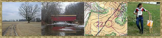
    Aid station controls are shown on the map with a cup symbol. There are several restrooms located throughout the park (generally portable toilets). These are shown on the map with an “R.” Most are not located directly on the course routes.

    Budget your energy wisely. Keep in mind that your actual distance traveled will likely be 10-15% longer than the straight-line distance. Consider walking on uphills to conserve energy.

    Lanyards are provided with the e-punch cards. Please make use of them to prevent losing the card. The fee for lost or non-returned e-punch cards will be $70. After completing your course, remember to go to the Tea Barn to download and turn in your epunch card.

    Special notes for Marathoners:

    Be careful to go to control #1 leaving the start triangle and not control #23.

    After reaching control #22, you will pass through the Half Marathon finish area. There is no need to punch the finish box at the halfway point (if you do, it is not a problem) – just continue on to control #23.

    If you reach the halfway point and decide not to continue on the second half of the course, punch the finish box. Your results will be included with the Half Marathon finishers.

    If you do not make it to the halfway point by the 12:45 pm cut-off, you will not be permitted to start the second half of the course. If you do not make it to Aid Station 5 (34.5 km) by the 3:15 pm cut-off, you will be asked to stop and will be transported back to the finish.

    If you decide you need to drop out, proceed to the nearest Aid Station - the volunteers there will make arrangements to have you transported back to the finish.

    The second half of the Marathon course is a little easier than the first half. Be sure to save enough energy for the final gradual uphill to the finish area.

Aid Stations

    There will be two staffed aid stations on the Half Marathon course and four on the Full Marathon course. In addition, the finish area for the Half Marathon will serve as an aid station. The Half Marathon course is the first half of the Marathon course. Full Marathoners will pass through the Half Marathon finish area at the halfway point of their course. Aid stations will feature an assortment of beverages as well as some light refreshments (bananas, cookies, pretzels, etc.). Participants are also welcome to bring their own refreshments to be placed at the aid stations by event volunteers. Any individual refreshments provided by the participants for placement at the aid stations should be placed in a closed bag, labeled with your name, the aid station number (see below), and turned in at the designated area in the Tea Barn at registration. Aid station details are as follows:

    Half Marathon Aid Stations:

    Number  Straight Line Distance
    AS1  7.0 km
    AS2  15.6 km
    AS3  21.1 km (finish)

    Marathon Aid Stations:

    Number  Straight Line Distance
    AS1  7.0 km
    AS2  15.6 km
    AS3  21.1 km (Half Marathon finish)
    AS4  27.6 km
    AS5  34.5 km
    AS6  42.2 km (finish)

    In addition to the aid stations, hot beverages and soup will be available in the Tea Barn following completion of the courses for all participants (included as part of the event fee).

Medical Assistance

    Aside from first-aid, no Medical Assistance will be available at the event center. The nearest medical facilities are:

    Newark Emergency Center (Google Maps)
    324 E. Main St.
    Newark, DE
    302-738-4300

    Union Hospital (Google Maps)
    106 Bow St.
    Elkton, MD
    410-398-4000

Registration and Fees

    Pre-registration is required. Click here for online registration.

    List of registered runners is available here.

    Payment can be made online using Paypal or by mailing a check to the registrar. The registrar's address is:

    Fred Reed
    1118 Chestnut Tree Rd.
    Honey Brook PA, 19344
    omarathon2@verizon.net
    (610) 942-7359

    Event fees:

    Half Marathon: $25 until 11/30/09, $35 after 11/30/09
    Full Marathon: $35 until 11/30/09, $45 after 11/30/09

    1:10000 Maps: $5 (the standard will be 1:15000. Those requesting 1:10000 maps will have to carry 3 maps for both the Half and Full courses. Those using the standard 1:15000 maps will only need to carry a single map).

    Classes:

    Junior Female/Male (<21 as of 12/31/09)
    Open Female/Male
    Masters Female/Male (45+ as of 12/31/09)
    Not Competing (those selecting this class will not be eligible for awards)

    Early Starts:

    If you need an early start time, please indicate this along with your desired start time under the special requests section of the on-line registration form.

    Waivers:

    All participants must sign the waiver form. Waivers must be turned in at the registration area prior to the start. Extra waivers will be available at registration.

    SI cards:

    Si fingersticks will be provided for all participants. To simplify registration, use of personal fingersticks will not be allowed.

Awards

    Small awards will be offered for the first and second female and first and second male finishers in each class.

Lodging

Event Personnel

Sponsored by the Delaware Valley Orienteering Association

 
DVOA
 
banner